Figure 1 Yazoo river backwater flooded areas north of Redwood, MS 4/1/2011

Figure 2 Looking toward Vicksburg and the river May 14,2011 from 2000’. The Headquarters of the Vicksburg District, on Clay St., of the U.S. Army Corps of Engineers is shown in the foreground.

Figure 3 Aerial view from 2000’, looking past the Vickburg National Military Park toward the flooded areas of the MS river. The town of Vicksburg is on the left. May 14, 2011

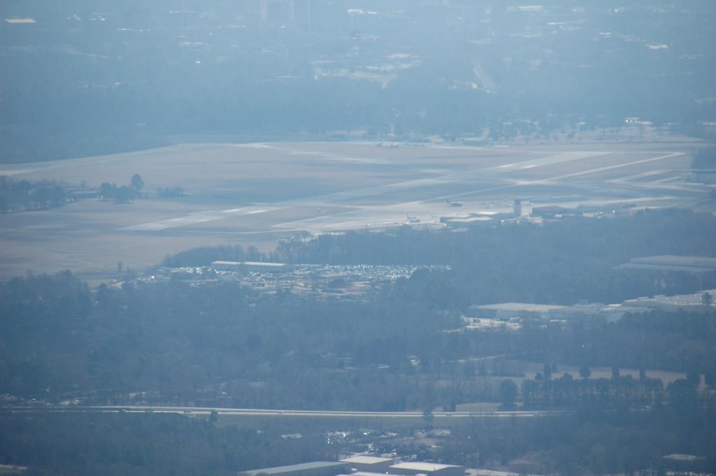
Figure 4 Flooded areas north of Vicksburg around the HWY 61/HWY3 interesection and the redwood Elementary school. May 14,2011

Figure 5 Farm north of town on Highway 3 just on the border between the MS counties Warren and Yazoo. I lived here for a couple of years in the 1960s when my stepfather Henry L. McKnight owned about 400 acres around this current property. 4/1/2011 I checked again this month and this area was protected from backwatering flooding by the new levees when I flew over 5/20/2011.

Figure 6 First of a series of backwater flooding areas west of HWY 3 south of the Hearn farm and north of the Simrall’s planation. 5/20/2011

Figure 7 Second photo in the series flying west of HWY 3 and south toward Redwood, MS 5/20/2011

Figure 8 Third in the series taken from 2000’ flying south toward Vicksburg while still north of Redwood.

Figure 9 Backwater levees south of Redwood, north of Vicksburg east of Eagle Lake

Figure 10 Fifth in the series showing the Steele Bayou flood control structures. As of the date of this photo 5/20/2011 they had not overtopped as predicted by the Corps a week earlier. Definitely good news for the people farming from here up toward Rolling Fork, MS .

Figure 11 Next in the series flying south toward Vicksburg and the Port of Vicksburg area. The west sides of these levees are covered/reinforced by rubber sheets (for about 5 miles according to the Corps press release).

Figure 12 Final photo in the series showing the Port of Vicksburg area in the upper right.

Figure 13 Yazoo river flooded areas around Sartaria, MS. For some other pictures backwater floods in this area see the blog posting from two years ago.

Figure 14 More backwater flooded farm fields north of Redwood, MS.

Figure 15 Flooded areas around Sartaria.

Figure 16 International Paper Company site north of Redwood, MS.

Figure 17 May 14 photo of same location


Figure 18 Flooded areas of Delta National Forest northwest of Redwood, 4/1/2011.

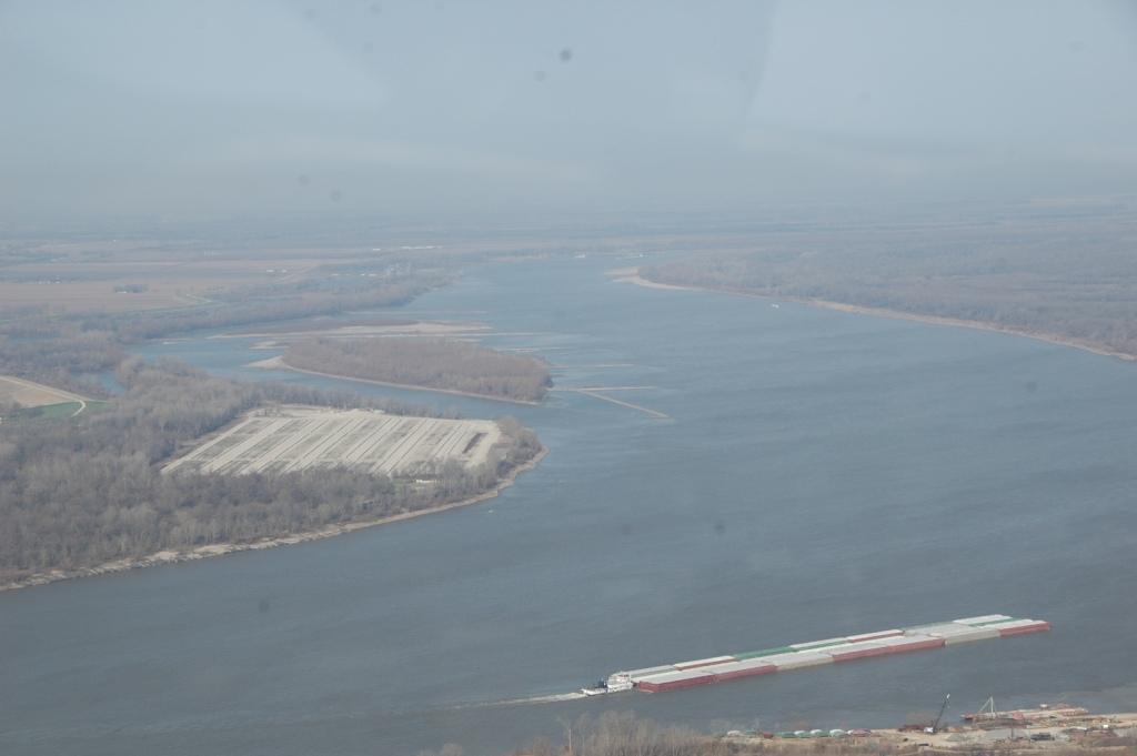
Figure 20 Towboat pushing river barges on the river just north of the Eagle Lake area.

Figure 21 Flooded grain terminal site on the west side of the MS river north of Vicksburg. May 14,2011

Figure 22 Tara wildlife refuge, Eagle Lake, MS.

Figure 23 Hunting lodge just south of Eagle Lake.

Figure 24 Steele Bayou, Yazoo river control structure which is located just east of Eagle Lake MS, north of Vicksburg.

Figure 25 May 14 photo of Steele Bayou control structure

Figure 26 May 14 photos of backwater levees south of the Steele Bayou structure which protect the area going toward Rolling Fork. The north side of the levees have been reinforced with vinyl covers (looked like for about 1 mile).
Figure 27 Backwater area of the Yazoo between Redwood and Yazoo city west of state HWY 3 4/1/2011

Figure 28 Anderson Tully lumber yards located north of Vicksburg, MS just off of Hwy 61N.

Figure 29 May 14 photo of same area

Figure 30 Port of Vicksburg, MS located north of town.

Figure 31 May 14th photo of this

Figure 32 another May 14th photo of this area

Figure 33 I-20 Interstate Hwy Bridge one of two bridges that cross the MS river at Vicksburg. In this picture taken April 1,2011 some tow boats are trying to remove some barges that got caught on the bridge piers. The accident was caused by the unpredictable high water current condictions which exist when the river is at a yearly high water cresting mark 43.3 ft. Top ten historical flood stages reached during the past 10 years are 1) May23,2010 42.8, 2)May 27,2009 47.5, 3) April 19,2008 50.9, 4) Jan. 31, 2005 44.5, 5)May 29,2003 43.0, 6)June 3, 2002 45.4, 7)May 14,1998 43.6, 8)March 22,1997 49.1, 9) May 27, 1983 49.3, 10)May 13,1973 51.6. Source Vicksburg Post, Friday April 1,2011.

Figure 34 The Tomato Place, a good place on Hwy 61 South of town to stop for lunch.

Figure 35 Flooded areas west of the Tomato Place, May 14,2011

Figure 36 On the west side of the Ms river from Vicksburg at Delta La is where a large number of concrete mats used to stabilized the Ms river banks are stored.

Figure 37 Flooded areas around Letourneau, MS May 14,2011.

Figure 38 Another photo of the same area

Figure 39 Ms river banks on its east side just north of where the Yazoo river diversion canal enters the river south of the city of Vicksburg.

Figure 40 Vicksburg waterfront from 2000’ May 14 without telephoto lens, another photo of this area before the floods and some photos of the Vicksburg area with the telephoto lens see the web site:
http;www.ourprayergroupnews.blogspot.com

Figure 41 East side of MS river looking south from the downtown area toward the Interstate bridge and the railroad bridge.4/1/2011

Figure 42 May 14 photo of same area

Figure 43 Looking at Clay St. in the east side of downtown Vicksburg and the former Mercy Hospital which was run by the Sisters of Mercy for many years.

Figure 44 The island of St. Martin in the eastern Caribbean ocean. A Dutch/French protectorate 186 nm east of Puerto Rico, which is the site of the training for the America’s cup sailboat races. Picture taken from the New Holland cruise line ship Neuew Amsterdaam.

Figure 45 Sea harbor at St. Martin